Although we had rain over this past weekend, we had very little, if any, rise to the Lower Susquehanna River. The river level reading at the Harrisburg, Pa. NOAA river predictor gauge only read 3.34' yesterday with a predicted rise to 3.5' by today. That calculates into a approximately 1.8" rise overall. Just enough rise to put that "prop buster" rock slightly underwater.
But even more important for us who fish the Lower Susquehanna River is how the dams are regulating the lake levels. For example, a 169.75' level on Lake Aldred means that the water at the Holtwood Dam would be spilling over the dam wall. From Memorial Day Weekend (late May) until Labor Day Weekend (early September), the Safe Harbor and Holtwood Dams are regulating by Federal law to keep the river level in Lake Aldred at "recreational levels". This allows boaters an opportunity to launch and run most of the lake without much worry about damaging their rigs, especially at the launches.
However, as reported in their website, PPL reported that Federal law that demand "recreational levels" expired on September 15, 2013 until the next (2014) Memorial Day Weekend. That means, the dams can and will start to drop or raise the river levels o Lake Aldred and Lake Clarke at will without concern for the boaters.
However, one can keep an eye on the daily proposed Lake Aldred levels at the site below...
Lake Aldred Levels
I would highly recommend that if you have a desire to fish or hunt water fowl on Lake Aldred that you first check this site before venturing onto the Susquehanna River.
The main stem has been running low (3.34') and it creates more likelihood for damaging our rigs on boulders, large rocks, and sharp ledges. Low water conditions create more work for aluminum welders and local marinas. It's a blessing in disguise for those who make additional money on the unfortunate boaters who damage their rigs while running under such low water conditions.
Since the main stem has been running low, I decided to take my chances launching the new Lake Aldred knowing that the river level controlled by the two dams was going to be 164' at 8:00 a.m. and drop to 163' by 5:00 p.m. In other words, the dams were going to be dropping the Lake Aldred water levels to approximately 6' below spill level at the Holtwood Dam. This translates into a very dangerous level for those of us who venture north towards the rock garden and just below the Safe Harbor Dam. In fact, I cannot remember the last time I ran my jet rig on Lake Aldred at this low level . The Pequea Creek at the two older ramps at the Pequea Boat Launch (PPL) always ran too low to launch boats at these levels.
New Pequea Boat Launch - PPL
Zach and I decided that we would test the new ramp yesterday at this low level.
When we arrived, a little after noon, there were only four other trailers in the PPL Pequea Boat Launch parking lot. By the time we returned at 3:30 p.m., we were the only brave souls still boating on the lake. The lake level had dropped a good foot or more than when we launched.
The water was quite dingy due to the rapid drop. The water temperature was holding at 65.2 degrees and the air temperature was a comfortable 70 degrees. The sky was mostly clear with an occasional cloud passing. We were never out of the sun and under cloud cover the entire time on the water. There was a brisk wind blowing from the north.
We started fishing at one of my favorite Fall spots just to see if any fish were holding on a sharp drop off I had located years ago while still tournament fishing. I got two hits at this spot even though the water was so low that old tree stumps were showing in the channel between the islands.
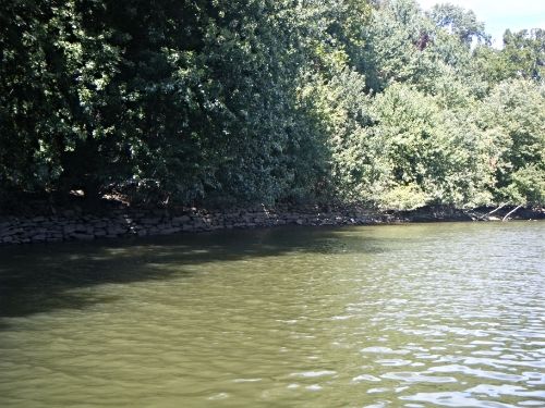
At the one area we fished, the wall for the Susquehanna Canal Company and Tidewater Canal Company was showing quite well
Susquehanna And Tidewater Canal

After fishing this area for the first hour, we decided to make a run upriver towards the Safe Harbor Dam. I can truly say that I have never run this area, including the Conestoga River channel, at such a low level. I took my time while on plane to make sure I didn't come in contact with any unexpected rock or boulder that I am used to running over when the water is at recreational levels...
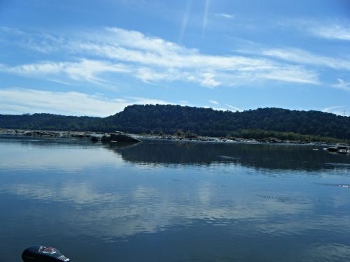
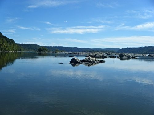
You can see by these pictures how many rock were exposed. We use the waterlines on the rocks and shoreline to determine the rise and fall of the Lake Level.
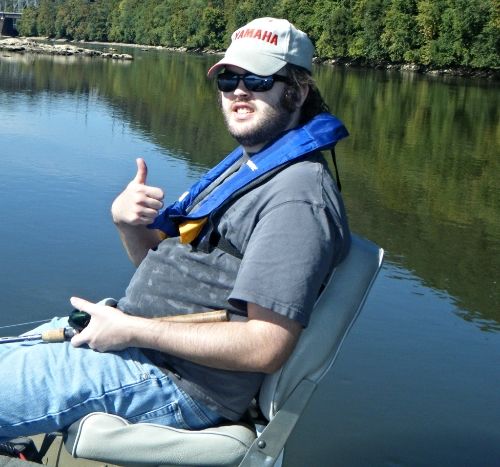
The picture below shows Zach on the back of my jet rig giving the thumbs up because we had made it safely to our upriver fishing destination. If you notice in the left background is the Conestoga River channel that is normally much, much wider. The rocks to Zach's righthand side (left side on pic) are usually under water.

A couple of more pics of the many exposed rocks and boulder within the rock garden below the Safe Harbor Dam...


The above photo shows us facing south towards Pequea, Pa. To the left, is the opening between the shoreline and the first island as you enter the Conestoga River channel. Just below that spot, there were a lot of exposed rocks that I don't ever remember seeing as I ran north to fish. Keep in mind, I've been fishing this area for over 30 years!
This entire fishing adventure was more of a learning experience for me than it was a fishing one! With the introduction of the new ramp at the Pequea Boat Launch (PPL), we will be able to fish the lake at much lower levels in the future than we have in the past.
Be aware that PPL recently replaced the ramps at the York County Furnace Boat Ramps. However, these newer ramps were not extended to allow launching at low water levels.
Take Care and Be Safe!
Dad
